Volcano Mt. Merapi - the people

|
|
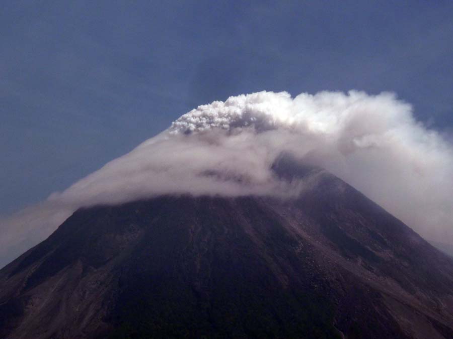
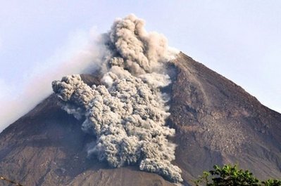
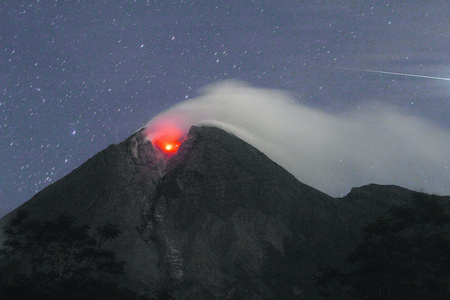
This picture was taken two weeks before Mt. Merapi erupted on Oct 26, 2010. Twenty people died in the area where these photos were taken. On close up, Mt. Merapi was rugged, untamed, and volatile. It was located 18 miles from the densely populated city Yogyakarta in Central Java, Indonesia. |
|
|
|
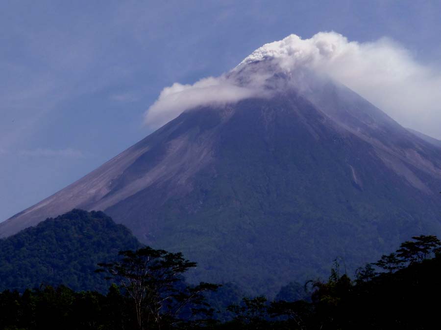
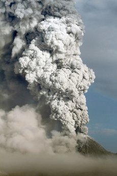
From a farther distance, Mt. Merapi showed its majestic beauty with steam and hot gases venting from the top. |
|
|
|
Thousands of trees were planted after the 2006 eruption covering the charred land. The area was green, looked normal, and appeared harmless. |
|
|
|
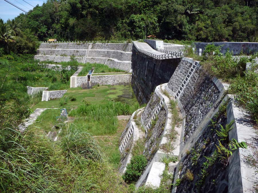
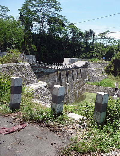
The government built special dams below the volcano to control future mud and lava flows. |
|
|
|
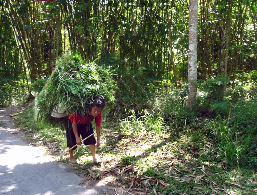
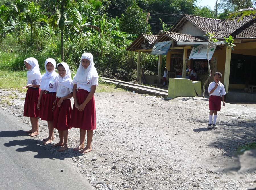
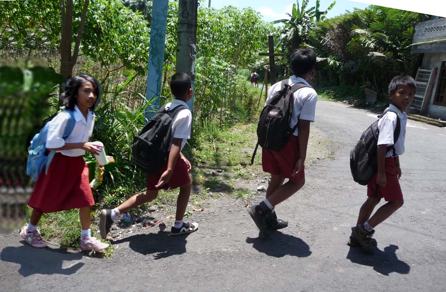
Villagers returned after each volcanic eruption to live and to work on their land. They were mostly farmers. After living there for generations, they had no place to go. This woman was carrying grass and vegetation collected from the hills above her village to feed her sheep which later could be sold so she could put food on the table and to educate her children. |
|
|
|
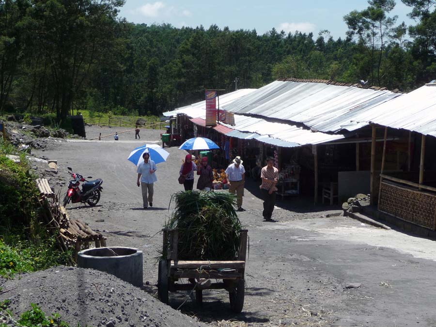
Small businesses and villages recovered and strived after each volcanic eruption. |
|
|
|
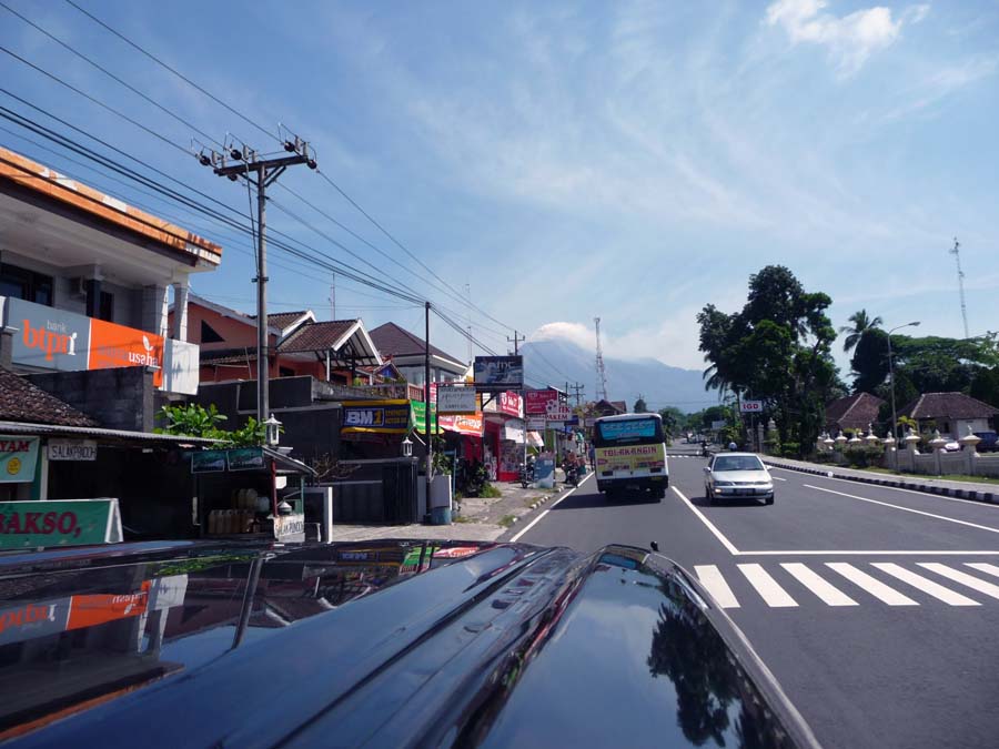
Away from the mountain and further towards Yogyakarta, there were many modern businesses, art centers, and universities though the primary industry remained to be agriculture. A local sign, Salak Pondoh or snake fruit, can be seen on the left side. |
|
|
|
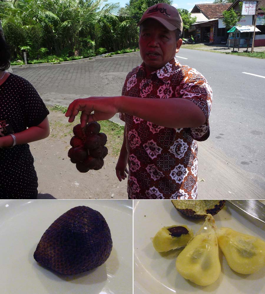
Salak Pondoh or snake fruit 蛇皮果, was the primary produce in Central Java and was said to originate from Mt. Merapi. The popular crop, a species of palm tree, replaced rice in recent years due to its higher yield and better market return. A Salak Pondoh plantation was seen in the background. The surface of Salak Pondoh was reddish-brown in color and resembled the skin of a snake. The skin had a texture similar to lychee. When dissected, Salak Pondoh had three lobes like that of garlic cloves. It was edible with a sweet and acidic taste. |
|
|
|
One week before the 2010 eruption, the government warned the people about the imminent danger. Thousands of deep and shallow volcanic earthquakes were recorded. Hundreds of smaller avalanches were observed. Water content and gas escaping from the mountain were greatly reduced, suggesting the internal condition of the mountain was very hot and danger was forthcoming. |
|
|
|
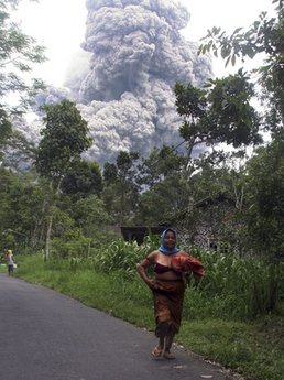
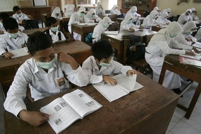
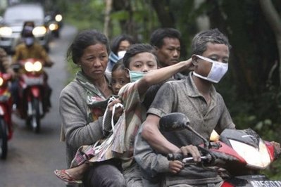
Thousands of face masks were distributed to local residents to protect them from volcanic dust in case of an eruption. More than 100,000 people living on the mountain had been evacuated to emergency shelters. But as expected, not too many people were willing to leave their homeland where they had lived and worked for generations. Some stayed in the shelters at night but sneaked back to their homes during the day to feed their livestock. |
|
|
|
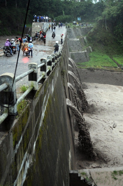
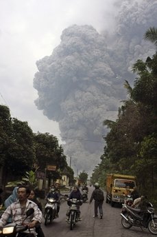
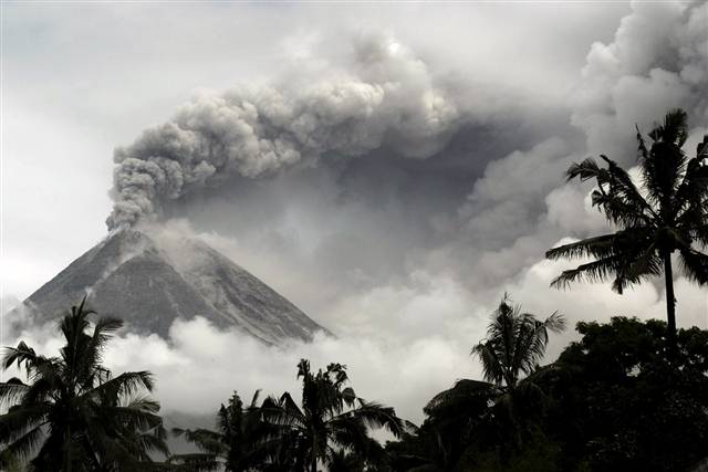
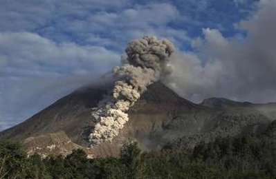
Then on Oct 26, 2010 Mt. Merapi blew its top which created a
pyrocrastic flow comprised of volcanic gases, ashes, mud, hot
clouds, pulvertized rocks, and lava. The molten composite
rushed down the south side of the slope where all these
pictures were taken at the speed of 100 mph and with a
temperature of 2,000 degree-F, destroying everything in the path.
|
|
|
|
|
|
|
|
|
 |
 |
|
|
|

|
|
|
|
|
|
|
|
|
|
|
|
|
|
|
|
|
|
|
|
|
|
|
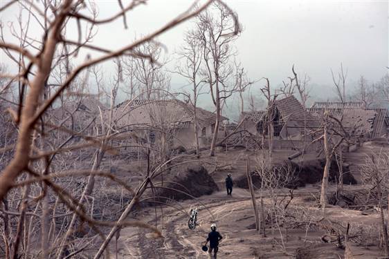
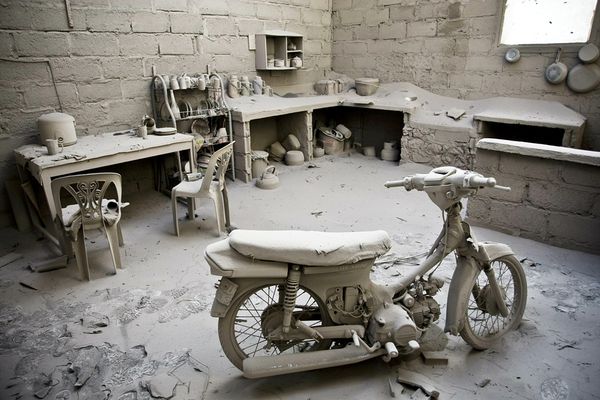
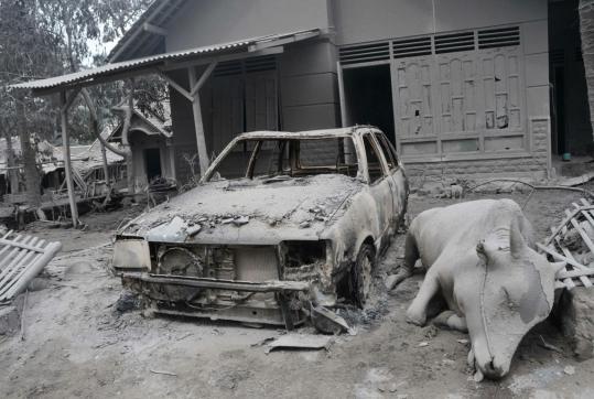
The morning after. |
|